What Is the Coastal Edge Line in Turkey? What You Can Build on Seaside Land
🇹🇷 This article describes regulations and processes specific to Turkey. Requirements differ in other countries.
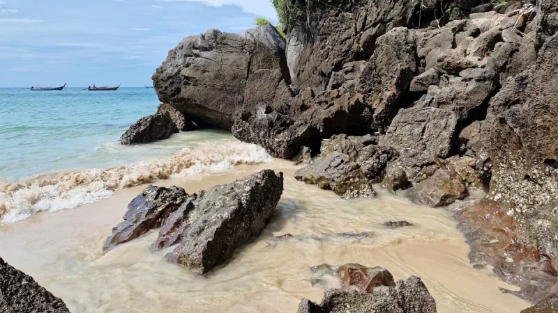
A plot with a view on the Black Sea coast looks appealing, but its distance from the shore directly determines what can legally be built on it. We explain the boundaries set by Turkey's Coastal Law and what they mean in practice.
The information in this article applies to Turkey. A plot with a view along the Black Sea coast looks attractive as an investment, but the plot's distance from the shore sets legal limits, defined by law, on what can be built on it. Investing in coastal land without knowing this boundary can lead to serious disappointment.
The difference between the shoreline and the coastal edge line
The shoreline is the line formed by joining the points where water meets the land, excluding floods. The coastal edge line is a more permanent boundary: on low, flat coasts it marks the landward natural boundary of areas shaped by water movement, such as beaches, gravel, rocks and reed beds; on narrow, high coasts it is the upper edge of the slope or cliff (falez)[1][2].
What does the Coastal Law say?
The area between the shoreline and the coastal edge line, the coast itself, is open to everyone and as a rule nothing may be built there. The exception is structures built by zoning plan decision for public use and protection of the coast, such as piers, harbours, landing points and bridges[1]. Privately owned structures such as houses and villas cannot be built in this zone.
The coastal strip and the 50-meter setback
The law defines a band at least 100 metres wide, measured horizontally inland from the coastal edge line, as the "coastal strip". Buildings in this strip may come no closer than 50 metres to the coastal edge line; the area in between may only be laid out for footpaths, promenades, rest, viewing and recreation[1]. In a coastal strip with no implementation zoning plan, nothing at all may be built within these distances[1].
What this means in practice for cliffside (falez) plots
Because on cliff (falez) sections the coastal edge line runs along the top of the slope, a plot being "sea-view" is not the same as it being "behind the coastal edge line and open to construction". The line is determined by a commission set up by the governorship and comes into force with the Ministry's approval; where it has not yet been determined, it must be determined within three months of a request[1]. Our Falez Villa concept study takes this topography as its starting point, on a model representing the cliff ground; on a real plot, the position of the building mass is set first of all by the approved coastal edge line.
Our process at MEEZ Mimarlık
When evaluating a plot near the coast, we check the approved coastal edge line map from the relevant municipality or provincial environment directorate to clarify the plot's real building potential. A step that needs to be taken before the decision to buy, not after.
Sources
- [1]Coastal Law No. 3621 (Kıyı Kanunu), Articles 4, 5, 6, 8 and 9. Official Gazette of the Republic of Turkey, 17 April 1990, No. 20495; the coastal strip provisions in Articles 4 and 5 were introduced by Law No. 3830 of 1 July 1992Last checked: 5 October 2026
- [2]Regulation on the Implementation of the Coastal Law (Kıyı Kanununun Uygulanmasına Dair Yönetmelik), Article 4 (definition of the coastal edge line). Official Gazette of the Republic of Turkey, 3 August 1990, No. 20594; the coastal edge line definition was amended in Official Gazette No. 21890 of 30 March 1994, and some other definitions in Article 4 were last amended in Official Gazette No. 33147 of 24 January 2026Last checked: 5 October 2026
Frequently Asked Questions
Are the coastal edge line and the shoreline the same thing?
No. The shoreline is the sea and land's point of contact at any given moment; the coastal edge line is the landward natural boundary of areas, such as beaches and rocky ground, shaped by water movement, and on narrow, high coastlines like cliffs, it's defined by the upper edge of the slope.
Can housing be built on a plot near the coastal edge line?
Only structures for public coastal use, such as piers or harbors, can be built between the shoreline and the coastal edge line; private structures like housing require a location behind the coastal edge line that complies with the coastal-strip rules.
How do I find out where my plot stands relative to the coastal edge line?
This information appears on the zoning status document or on the relevant municipality's or provincial environment directorate's approved coastal edge line map; it should always be confirmed against that map before buying land.